Today was supposed to be a day of four falls, but in fact I found five falls and still didn’t get to the four I had been hoping to.
Confused much?
I drove from Tullah back down to Rosebery and then the start of the Montezuma Falls Track at what I thought was quite an early time but there were still already three cars in the car park, and two more (including a bus of kids) turned up while I was getting ready to go. Who knew this area was so popular?
With that said, I was the only one on a bike and had passed the three groups who were all on foot well before getting to Montezuma Falls.
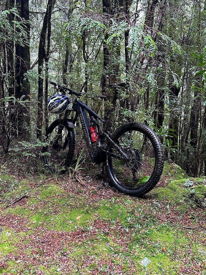
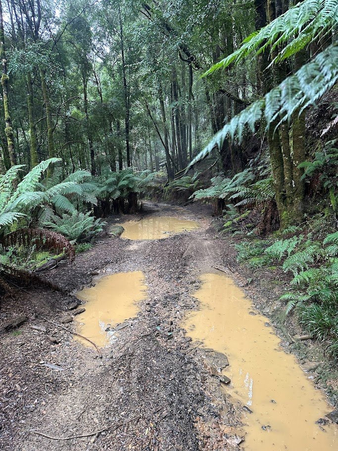
Although the flow was good at Montezuma Falls, that wasn’t really why I was there so after a few quick pictures, I gingerly pushed my bike over the suspension bridge losing my balance a couple of times which was a bit unnerving (I put it down to the extra weight of the e-bike) before continuing on along the now much muddier and wet 4WD access track.
It was still mainly fun riding and at least the puddles were mainly clear so I could see how deed they were before deciding to go through or around them.
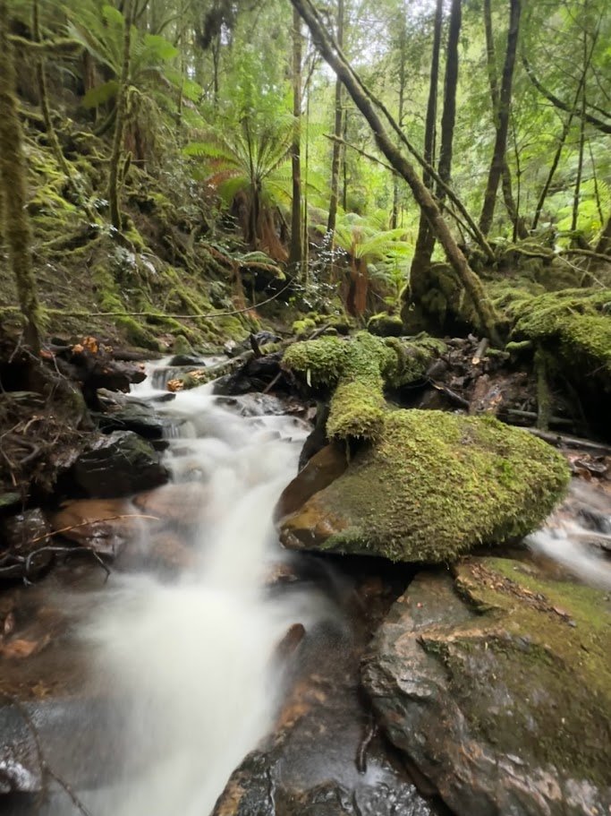
I got to the start of Frazer Falls (which was well marked with lots of red tape, plus is really obvious as Frazer Creek which you pass on your way to the start of the track is the only major washout on the track where you descend and ascend sharply into and out of the creek), right were the guide said it would be, but then made the impulsive decision to carry on to Rawlinson’s Falls and then work my way back out.
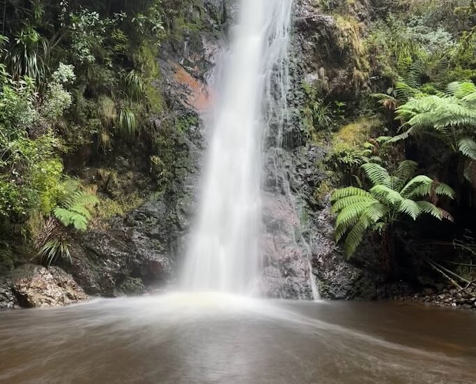
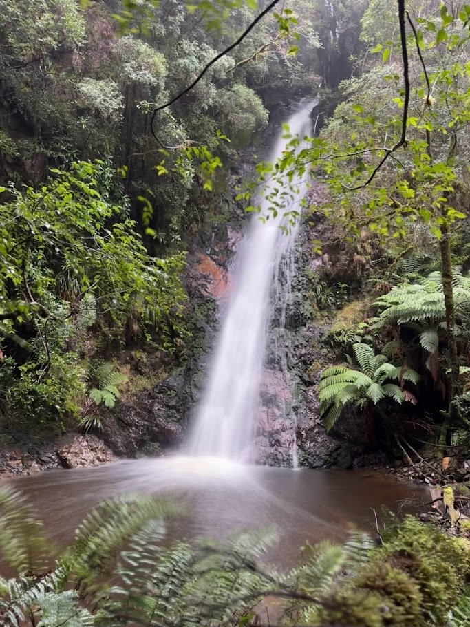
Rawlinson’s Falls was also pretty easy to find (though I admit to a few false creek crossing where I peered down to see if there was a waterfall below) but after pulling up and parking the bike next to the track, I did scratch my head and wander back and forth a bit trying to figure out the best way down from the track as all ways looked very steep.

In the end, seeing no one path that looked better than any of the others, I stepped off the track and began to slowly and carefully make my way downwards. About a third of the way down I started to see what looked like a bit of a path edging its way along the top the cliffs that surrounded the falls and from there it was a pretty easy deascent down to what I will call the best waterfall in the area.
Rawlinson’s Falls is just a beautiful little waterfall which I could have tried to photograph for hours.
But, I had other falls to get to, so after 10 minutes or so, I turned around and retraced my steps slowly back up the hill, this time following the ‘track’ to where it came out just on the Montezuma Falls side of a smaller creek that I had parked my bike near. Won’t say this was a better way up or down than what I chose as it did feel a little more exposed for the top section.
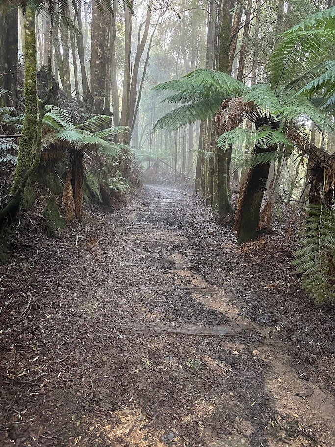
Retracing my steps to the Frazer Falls track, I pushed my bike up the track a short way to get it off the road and then started the slow climb up the ridge line. Now this track looks steep on a map (all those contour lines) and well it both doesn’t disappoint on the ‘up’ front, but also isn’t as bad as I thought it would be. What pleased me the most was that the track was pretty easy to follow, being either well taped or pretty obvious on the ground. After about 10 minutes there even started to be a series of yellow or red metal reflectors on sticks to mark the route.
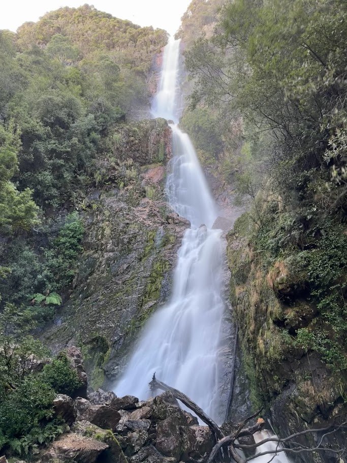
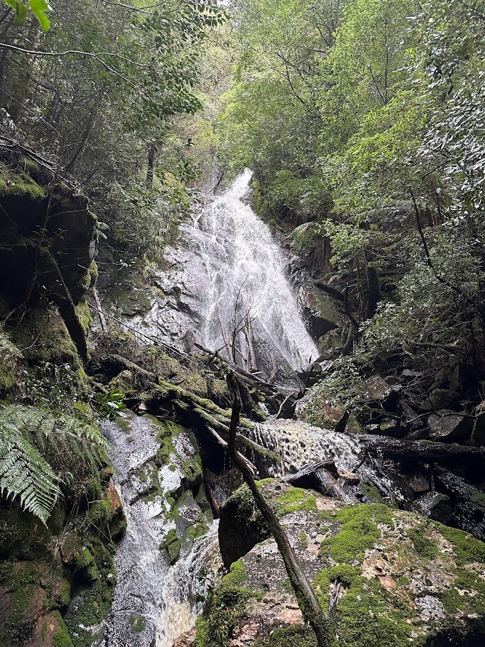
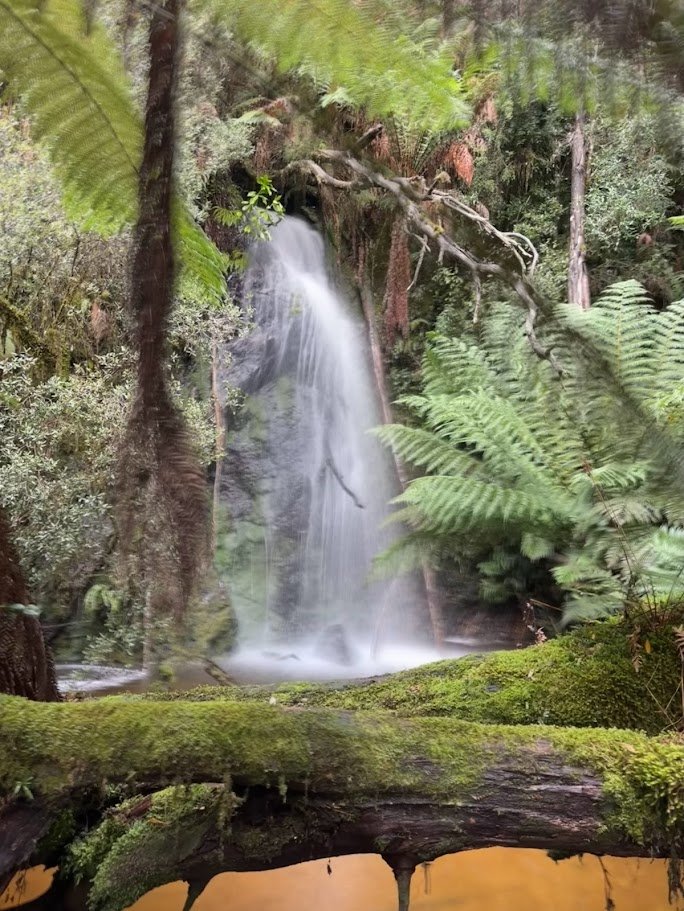
The track eventually comes out in this open area with lots of wood underfoot where you can hear the falls, and it would be easy to miss the sharp turn to the right which leads you into an obvious track through the cutting grass which sidles you around and to the top of the falls. Just before the falls there are a few signs. The first one says “base line” and continues up the ridge and the other points you to the top of Frazer Falls which is less than 50 metres away.

Just before the top of the falls, there is a second smaller sign with an arrow pointing you to the base of the falls and it is a very steep, but relatively easy, climb down to the base of the falls from here so long as you take it slow. There’s lots of rocks, goo footholds and trees and roots to help you slowly navigate your way down.
While big, I found Frazer Falls a bit underwhelming, albeit it was nice exploring around the base for a good spot to take a photo. I do also confess to staring off downstream and wondering “why can’t I just great back to the track that way?” Before starting back up the steep ascent to the top of the falls.

It was however (again) a much easier and quicker ascent than I expected (maybe heading out to Cumberland Falls yesterday made everything feel easier?) and a really nice walk back down to the bike.
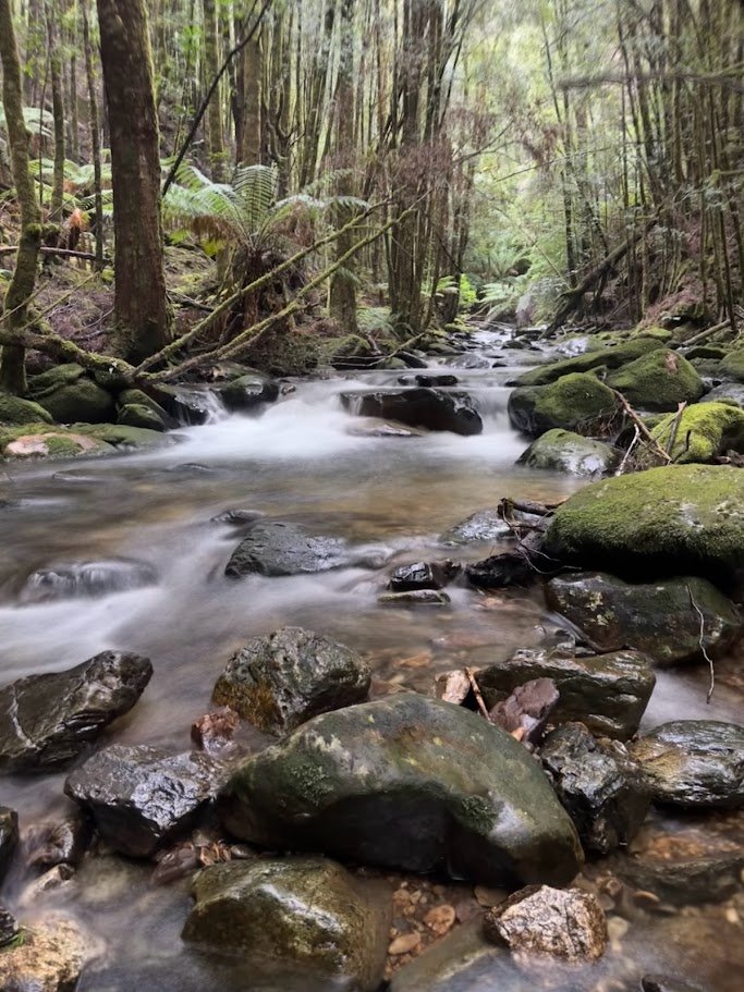
On the way back down to the bike, I did hear a 4WD revving its way along the track making me happy I had moved my bike a ways up the walking track. Reunited with my bike an heading back towards Montezuma Falls, I gazed longingly up Frazer Creek as I crossed it wondering how far up there was the falls, and in doing so I could see what looked like another obvious, unmarked, waterfall just glimsable through the trees.
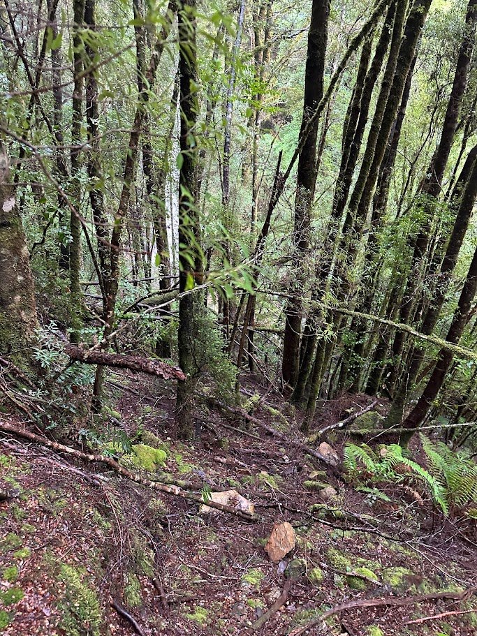
Intrigued, I dropped my bike on the side of the track and made my way about 50 metres up the (Montezuma falls) side of the creek to find myself at the base of a substantial, but unmarked waterfall on Frazer Creek and to be honest I found it much prettier than Frazer Falls itself although my photographic attempts did it no justice at all.
While there was no track as such up to the falls, it was a pretty easy and open scramble and well worth the 10-15 minute detour if you are in the area.
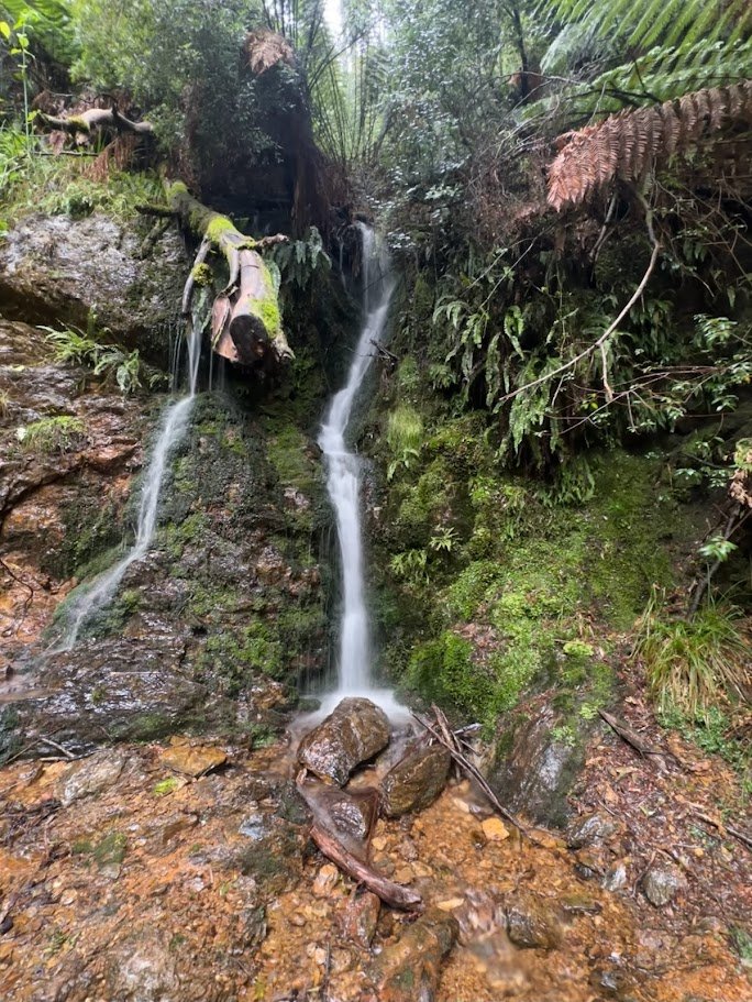
I caught up and had a chat with my 4WD friends at the Montezuma Falls car park, and they were the usual friendly bunch offering me water, beer and chocolate brownies (all declined) before we parted ways, them to Tullah for pizza and me trying to find my way to Svengali Falls, but capturing photos of one additional small waterfall alongside the track on my way back.
I got the warnings mixed up to this falls and thinking I had to start at the first major bridge (well the second bridge on the way out), I parked my bike behind the seat there and started following the beautiful little creek upstream on a well trodden trail just up from the creek. After about 100 – 200 metres the trail started to fade, so (luckily) I checked my GPS and discovered I was following the wrong creek.
I returned to the track and set off up the correct creek (from the second smaller bridge) and after 50-100 metres found the only viable way forward was to jump into the creek and start walking up that.
Now while it was a beautiful little creek, the going was slow, and after about 10 minutes of this sand seeing I still had a long, long way to go, I decided to call it for the day as it was 2pm (much later than I had expected to be out here), I had brought no lunch and I was feeling hungry and noticing I was starting to make some risky route choices as I tried to rush my way up the stream.
Better to call it a day and get home safe than push through and injure myself.
So that was my day. I did stop and take some pictures of some other small cascades coming down onto the track on the way out, but was back at my car before 3pm feeling really happy about how easy the e-bike made this trip and just grateful that there are so many gorgeous little places to explore in my own backyard.
Really loving this world of just stepping off the tracks less travelled and discovering this new world of the trails less trodden …