Getting to Cumberland Falls has taken me about 2 years – probably more.
My first attempt was when I was at Trial Harbour camping and while looking around on ListMap, I noticed that there was a track to a nearby waterfall and as it didn’t look very far, I decided to pop in for a visit on my way out. Turns out that if there was a track where ListMap shows it has long gone, and after 45 minutes to an hour searching for a track to the falls, I gave up and headed on.
But that planted the seed …
My next attempt was more more serious. I brought in the bike and packraft and this time cycled from Trial Harbour out to the Little Henty River heads and then inflated the packraft and paddled up the river to where Cumberland Creek comes into the river with the plan to just walk up to the falls along the creek.


It was genius … except I mistimed it badly, only arriving at Trial Harbour mid-afternoon and by the time I had pushed my bike out through the soft sand to the river mouth and then paddled up the river dodging submerged logs and the current … all I could do was appreciate the view of the (very low flowing) creek coming into the river before turning tail and fleeing back to Trial Harbour arriving back at my car just as the sun set.
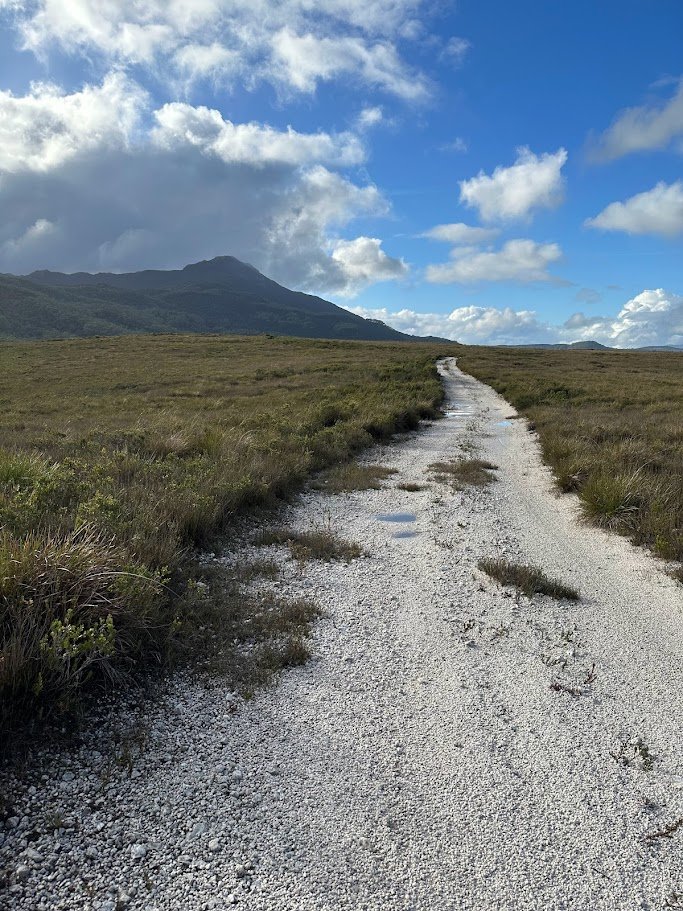
Attempt #3 was after a day riding the new Silver City Trails in 30+ degree heat. I was already cooked when I finished the ride, but with a few hours of sun light left, I decided to try in squeeze in a quick dash to the falls, so headed to the start of the track and rode out to the most promising route I had seen on my first visit.
This time, I noticed what looked like a small track heading off into the bush just before the end of the ‘main’ track and so I headed into this and was excited to find a fairly well trodden, taped track heading off into the bush, so somewhat elated that I had found something, I set off following it. I even ignored when it started deviating away from the falls figuring that it must follow a new route. What I couldn’t ignore was a light headed feeling that started coming over me, and after clambering down a steepish creek bed (still following those tapes … ) I had one of those whoozy white out moments when my vision blurred and I had to sit down.
Realising that I was actually badly dehydrated, I beat a (very) slow retreat back to my car vexed at my stupidity of not even bringing a water bottle with me …
Which brings me to today, and attempt number 4. This time the plan was simple – head back to the track and get there early in the day, follow the track to where the route on the ListMap shows that there was a track heading to the falls and then basically follow that route to the falls whether there was a track or not. It looked fairly flat.
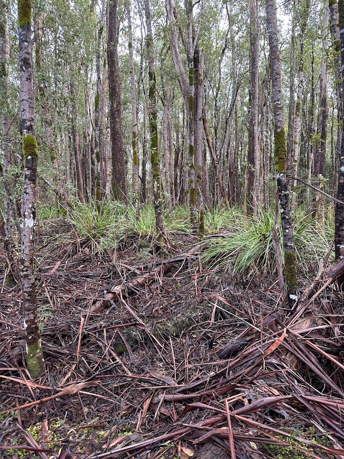
And that plan went fairly well … there was no obvious track heading towards the falls when I got to the point where my phone showed me there should be one, but there was a taped track coming in from the other direction, so confident I was in the right area, I headed off into the (fairly open) bush, crossed a creek, bashed my way through some cutting grass and then … much to my surprise … I stumbled across a taped tree.
It wasn’t easy to follow the tape from there (it was pretty patchy in places) but with a GPS to let me know when I had strayed from the route on ListMap (which is broadly correct, but not really) it also wasn’t hard to follow the route either.
After probably 20 minutes off track, I dropped down a hill into a completely dry creek bed which I assumed was Cumberland creek as the track started following it back up hill, but a quick check of the phone assured me I was still a ways away and after climbing gently back out of the creek and across a knoll I heard the sound of a running creek and saw some red tapes disappear down a very steep slope.
Now the West Coast has had lots of rain in the last week, so it was very wet and sloppy underfoot, and maybe it was that, or maybe it was just the steepness of the track to the falls, but that was one of the trickiest sections of track I’ve followed down to a waterfall yet (on par with the descent down to the Weld Angel Falls).
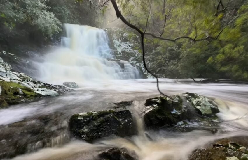
The final little scramble out onto some rocks to actually get a view of the falls was probably the most exposed bit, but it was worth it to come out onto what was a very substantial two tiers (at least) waterfall which each tier probably 10-20 metres high … and obviously a good volume of water going over it due to the rains.
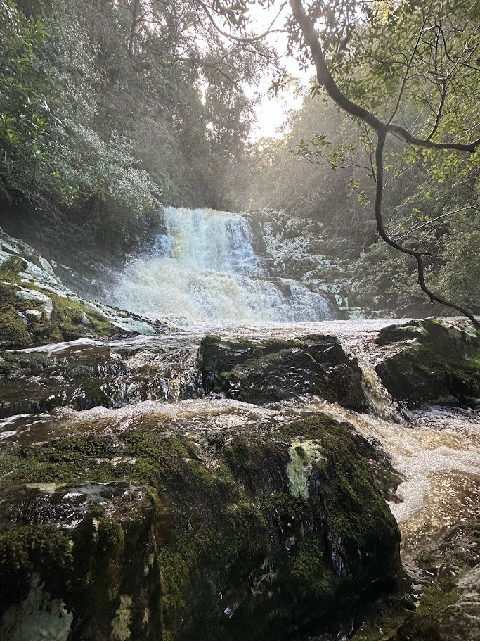
The taped walk dropped me out on a small ledge between the top and bottom tiers, and photography of the top tier wasn’t great due to the spray. There was no way I was heading down to the bottom of the falls, and the scramble back up out from the falls was a tricky, slippery and slow affair, but I had done it.
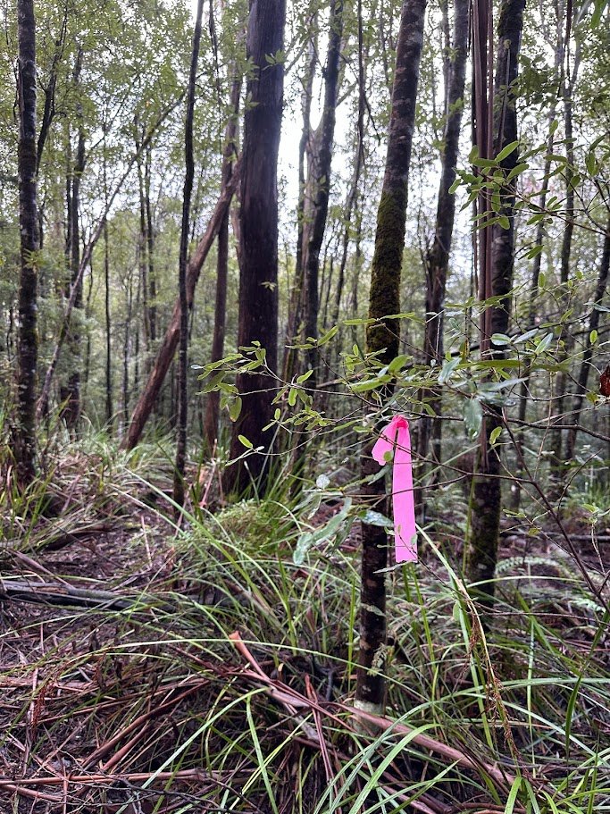
Returning back the way I came, I discovered that there was in fact a taped track all the way back to the ‘main’ track, but the first section is very hard to find. It starts about 20 metres down from where you turn off the old vehicular track into the walking track, and while there are some obvious pink ribbons off to your right, on the left (where you need to go) there is only one faded pink ribbon around a tree suggesting you should walk off into what looks to be very intimidating cutting grass. There is a decent track through that cutting grass if you look, and it very soon crossed a creek and becomes a lot more obvious to follow from there.
Definitely not a track for any but experienced off track walkers, but I loved it and am already planing trip #5 … this time I think I will see if that track I was on for attempt #3 goes all the way down to the Litle Henry River and if so, see if I can again pack raft up to to the bottom of the falls and get to the base of the falls from there.
That’s the thing I love about adventures … where every you go to, and wherever they end, there’s always one more step you can take to see what’s around the next corner.