I had the trip out to Hidden Falls (and Drizzly Falls) near the Three Thumbs Reserve / Orford marked as a relatively easy (2-3 hour) excursion which I could tick off sometime I wanted to go and visit a waterfall and still have most of the day to myself.
I was wrong, as I often am.
But I did have some reason to be confident this time – I had ridden the first section of my planned route (which was only about 5kms) before so had some expectation of what the route was like, and from there it was only 1km in a straight line to get to hidden falls. I mean that doesn’t seem like a 4 to 5 hour walk does it?
I didn’t think so, so heading off from the three thumbs lookout car park, I back tracked down the road a bit (I was on my eMTB otherwise I would have just parked at the start of the track) and then headed off along the old logging trails as far as I could go … which is about 5.3kms in which you lose about 200 metres in altititude (mostly towards the end, and don’t go thinking it is all downhill, because there’s a bit of climbing in there as well).
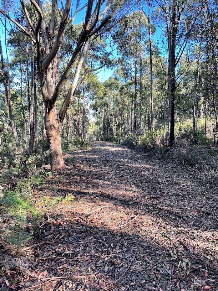
While still ridable, the track had deteriorated quite a lot since I was last here, especially the last kilometre which was getting quite washed out, but 30 minutes from the start I was leaning the bike up against a tree, pulling off the helmet and cycling gloves (putting on the scrub gloves) and heading off down the spur towards where the creek that has Drizzly Falls on it comes into Griffiths Rivulet.
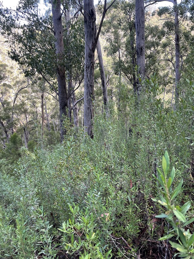
Now on listmap it is only 220 metres in a straight line from the end of the track to this point, albeit there is a drop of 110 metres over that short distance, and although I had hoped to find some sort of track or path or even fairly open bushland … I didn’t. What I did find was lots of slippery rocks, trees and quite a few sections where I had to very slowly bush bash and crash my way down to the creek. Let’s just say it took awhile, though I was never concerned and never felt in any trouble (spoiler – I did also find a much easier way back up later on which involves heading off in a south westerly direction from near the end of the spur almost as if you were trying to walk straight towards where Hidden Falls is shown on the map).
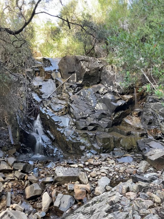
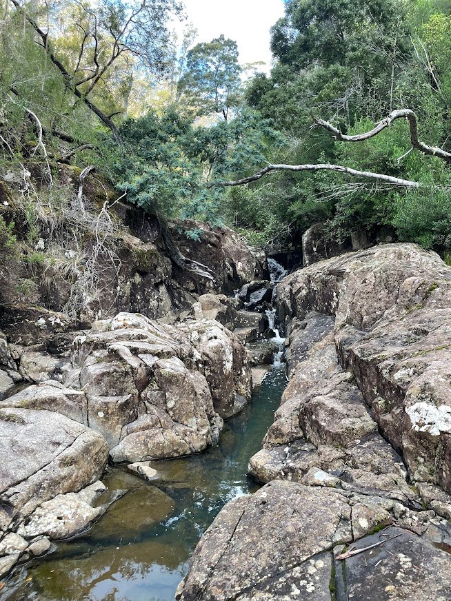
I was very happy to come out onto the creek, and doubly so when I saw that the creek was very nice and open and easily walkable. I was less excited when I walked the short distance downstream to where the unnamed creek which Drizzly Falls is on and there wasn’t a skerrick of water to be seen. Given it was only 200 or so metres up stream to the falls, I decided that I may as well wander up there anyway just to see whether it would be worth coming back some other time to see the falls. I was therefore happily surprised to discover water running about 50 metres further upstream, and I actually had to wade through a couple of small pools before I got to the bottom tier of the small falls.
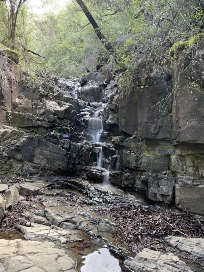

As I was to discover after a bit of a scramble upstream, there is a second, higher tier just up from this first tier, but by higher, it is still probably 4 or 5 metres high and this tier (which is probably the waterfall) had very little visible waterflow and was not particularly scenic, where as the bottom tier (which was more like a a 3 or 4 metre cascade) was in a bit more of an enclosed hollow and was actually quite a pretty spot.
After exploring upriver a bit further (and not finding anything else of interest) I had a decision to make – I could either continue on upstream and try and connect to a track which (on ListMap) looked to head over a pass and then back down near Griffiths Rivulet quite close to Hidden Falls … or I could backtrack to the river and come at the falls from below.
Given the bush I had been through earlier (and just how nice the walk up Griffiths Rivulet looked) I opted for the second option (a decision I was to be very happy about later) and backtracked back down to the Rivulet.
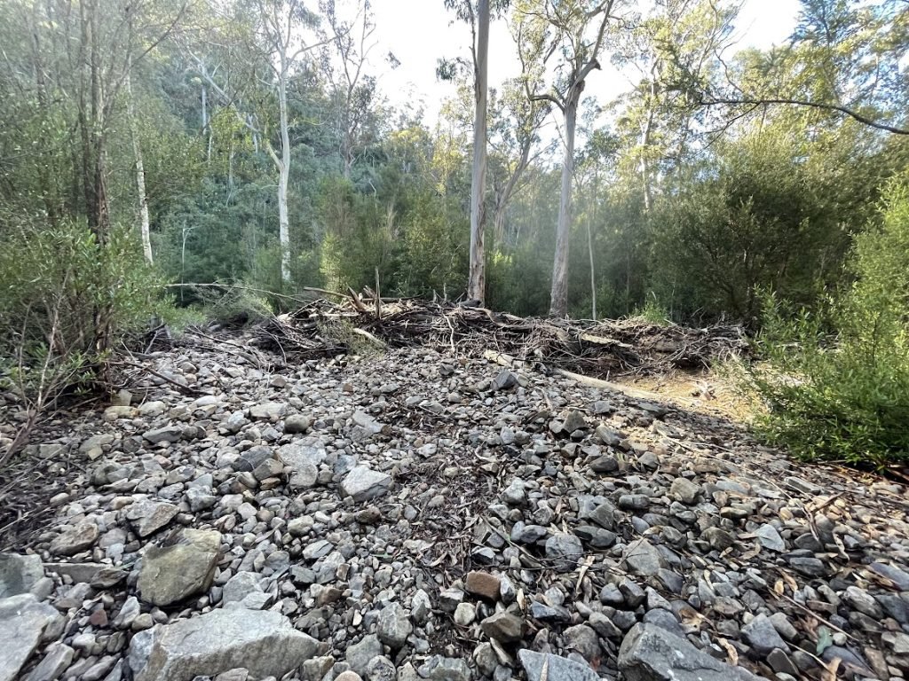
It was on my way back down that I noticed some huge piles of river debris pushed up above my head making me think that there must truly be some amazing flash floods come down through this area.
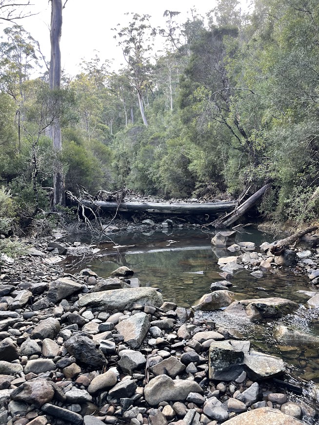
After retracing my steps, it was about a 1.4km walk upstream to Hidden Falls. The water level was perfect for walking and although I had to wade a few pools, I never got wet above my knees and it was just a lot of fun rock hopping and exploring my way up the creek.
The last few hundred metres did have a few trickier sections to navigate, but nothing I found overly worrisome but if you’re thinking of heading out on an off track walk like this, then I’d hope you’d have the skills and knowledge to know how to handle yourself. This is not a walk for the inexperienced.
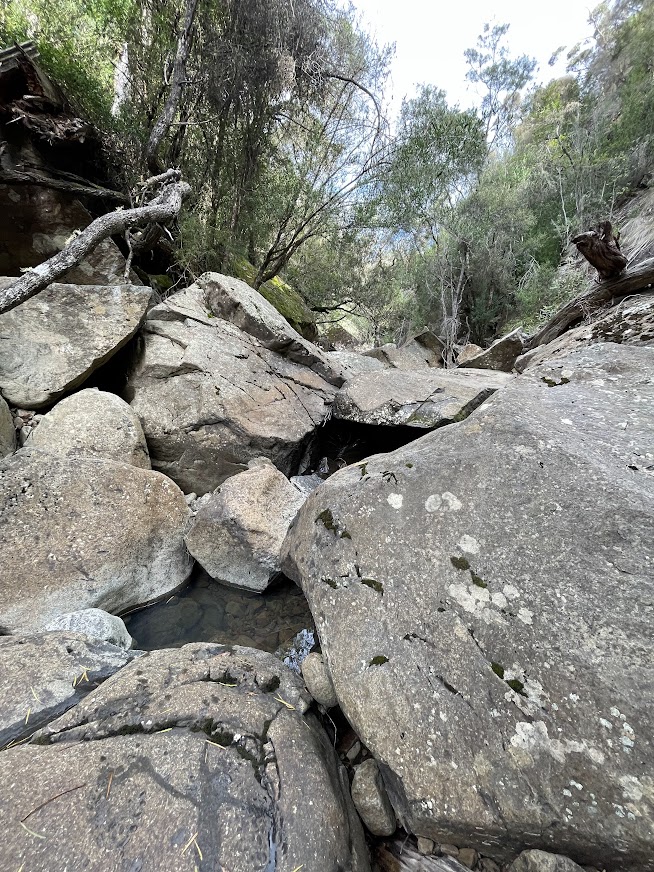
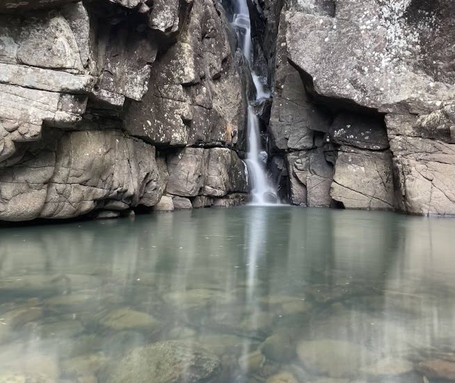
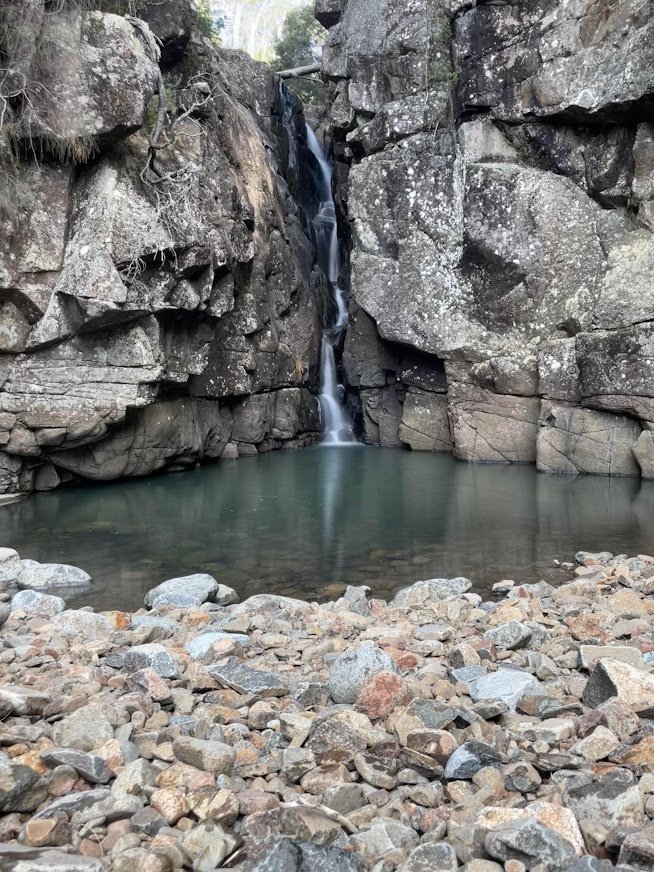
Hidden Falls itself was a beautiful little waterfall, made even more enjoyable by the last section which (not surprisingly) hides the falls until you push your way under a log to come out into this open ampitheatre like area with the falls running down between two cliffs into a little pool. It was a great spot for lunch, but it had also taken me two and a half hours to get here from my car, and there was still a lot of backtracking (and most of it uphill) to get out again.
I also noted to myself that there was no obvious way that I would have been able to get down to the base of the falls if I had come in from the top from that track. I suspect, I would have needed to bush bash my way down from the north western side of the creek to somewhere 50-100 metres below the falls and then made my way back up again.
After taking the obligatory pics and just enjoying being where I was, I turned tail and was surprised to find the walk back down the river much easier than the way up.
I also made the decision to head up the hill a bit further upstream. On my GPS it was where the straight line path beween the falls and the end of the track crossed the creek, but on the ground it was just before I got to a big log that was down over the stream about 250 metres upstream from the unnamed creek and where I saw what looked like a bit of a cleared area heading up into the bush.
Turns out this ‘cleared area’ was some sort of creek bed and basically I was able to follow this very clear (but very steep) gully most of the way back up to the road and it was only the last section where I had to make my way through some bush, but the bush was generally much more open than the way I had come down. I even put a very small cairn near where I came back out onto the (very end) of the track in case it helps others in the future.
Once back at my bike, I cracked open a celebratoy can of coke before being extremely grateful ofthe ease with which my Specialized Levo eMTB chewed up the climb back to the car.
All up, I think I was out on track for about four and a half hours, and it was a slightly tougher track than I had expected. It would have been nice to see the falls with a little more water, but I was also very concious that if there had been a lot more water, I may never have gotten to either falls.
An interesting conundrum.