Feeling the need to do a walk fairly close to home, but also somewhere new and a bit challenging, I decided to head off to Dora Falls, which is down in the Huon Valley.
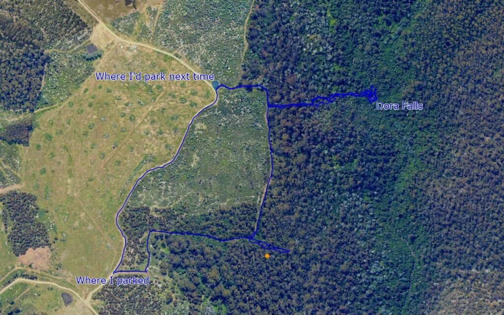
To get there you just drive down to just past Judbury (on Lonnavale Road) and then once you turn up Jacobsons Road continue for another 3.4kms until you come to a bid bend close to where the falls is marked on the map. Jacobsons Road is steep in places, and was a bit rutted when I drove up, but I had no real issues getting my front wheel drive BYD Atto 3 up there.
Now, while I give these nice clean directions, I in fact got this completely wrong. Firstly I drove well past this spot thinking to scout the road ahead for a possible circuit hike to Eldon Falls thinking I would return via what looked like a logged forest coupe and then walk back along the road.
This idea ended up in my doing a very long drive in reverse after heading down towards a creek as the road got more overgrown and covered in very large puddles whose depth was increasingly uncertain, before deciding to reverse out of there (due to their being nowhere to turn around).
I was also following the waterfalls of Tasmania direction which said to park near a sharp corner and then head up the road for 50 metres to a track heading into the bush, and noticing that there was no track heading into the bush 50 metres (or anywhere close) to where I planned to leave from (which was the corner on the road closest to the watefall), I decided to drive back down to where there was a really sharp corner and an obvious coupe boundary road heading off into the bush.
This was a mistake.
It wasn’t a tragic mistake, but as I learnt on the return walk, it added a lot of distance for very little benefit.
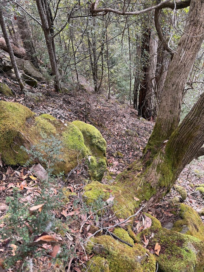
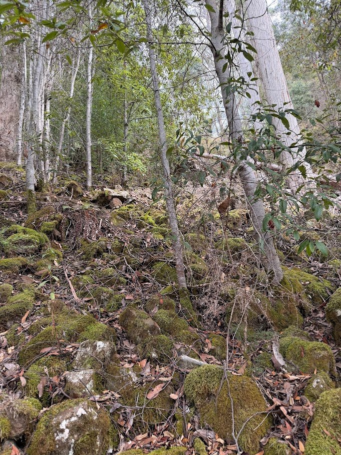
The track itself stopped after about 80 metres, but I could see on the old satelite map I had on my phone where the track was supposed to go, so was able to fairly easily follow this around until to where the track re-emerged and then follow this around the coupe.
While it was very easy walking, after about 450 metres, the track turned left and went sharply uphill and thinking it might be smart to instead try and contour around the hill, I headed off into the bush.
After spending 5 minutes making less than 100 metres, I decided this wasn’t such a good idea after all and headed back to the track and up the hill along the nice open forest track.
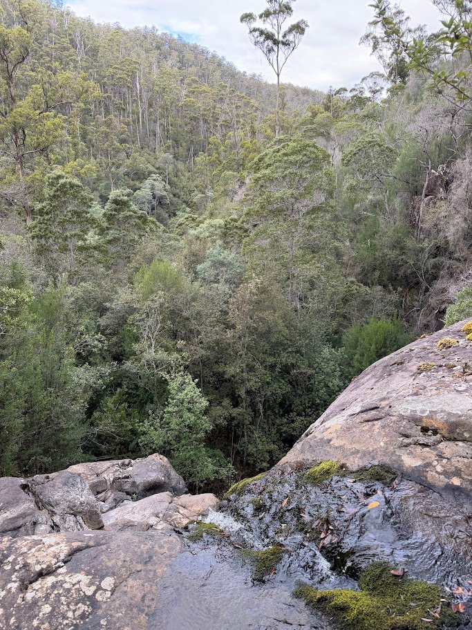
There’s no obvious attack point from where to head down when heading this way, so I just walked until I got to a spot that look as close as I could get to Dora Falls and where it was relatively open and then I just headed off into the bush and down the hill.
Not sure if I was lucky, or if the area is generally pretty open, but I actually found the bush itself pretty easy to get through as I sort of sidled down around the edge of a rocky area and then into an open ferny forest. The descent down to the falls was actually pretty fun (ignoring seeing one of the largest tiger snakes I’d ever seen emerge out from under a rock just in front of me) but it is steep.
You drop 150 metres in about 250 metres of forward walking to give it some perspective.
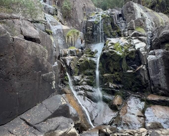
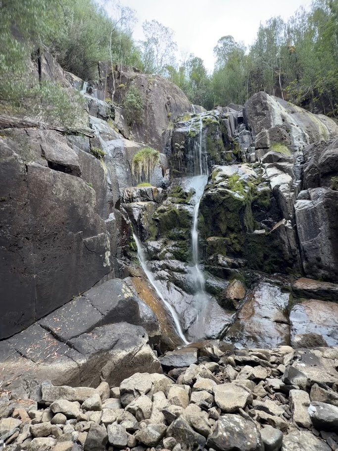
Now, having read that the falls have cliffs around the base, I had aimed to hit the creek about 100 metres downstream from where the falls are shown on the ListMap, so it was to my great surprise when I emerged out onto the creek … to find myself standing on top a significant waterfall.
Not sure if this was Dora Falls, I made my way down to the bottom (there is a fairly easy cliff scamble down on the other side of the falls for those who are comfortable with a bit of climbing) and standing at the bottom I was able to compare the falls with the picture I had on my phone from the waterfalls of tasmania website, and yep, this was Dora Falls.
There was very little waterflow, so I found the falls themselves pretty disappointing for the effort expended, and given how dry the area was I had no interest in carrying onto Eldon Falls on this trip, so after taking a few photos and having a bit of an explore, I scrambled back up the falls and returned up the hill roughly following my route down (but avoiding the snake area).
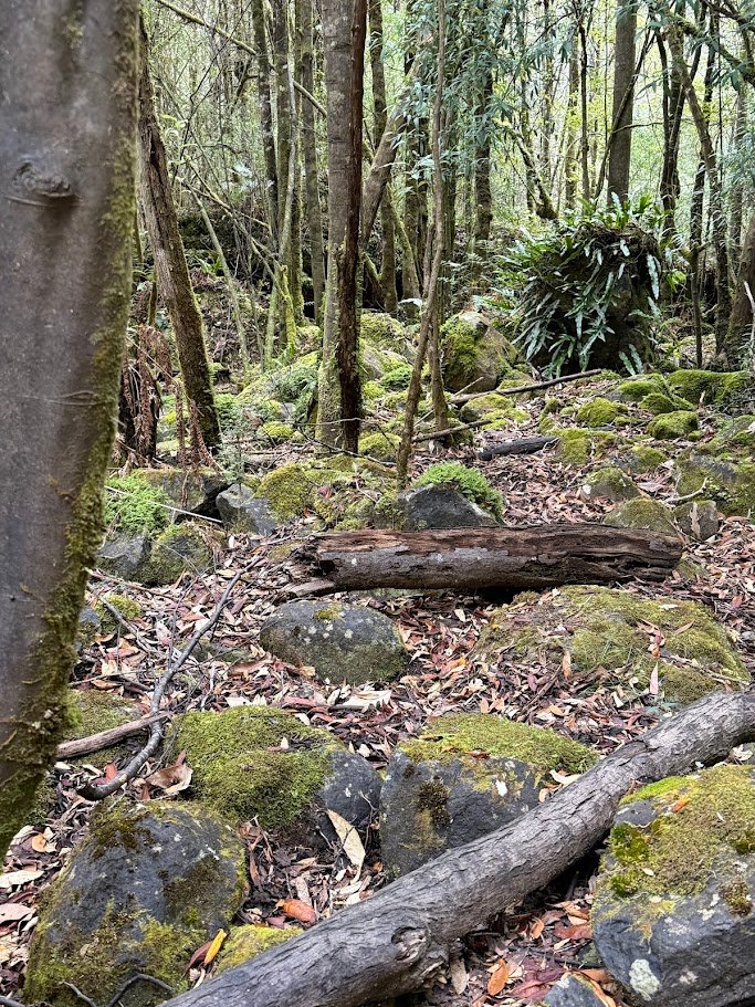
The climb back was pretty easy and fun (I just took it slow) and when I hit the coupe track, instead of following my route back to the car, I instead turned right and after following the track for another 30 to 50 metres, I came across an obvious little track heading straight towards the road and dropped out right where I had originally planned to start the walk from. It would have been so much easier to have come in this way, though without a GPS route to guide you in, the track I came out on is almost impossible to see from the road.
So that was my walk to Dora Falls. My route was 2.4kms and I was away from the car for about 2 hours (including 45 minutes ‘resting’), but if you just came straight in from where I came out onto the road, I reckon it would be a much shorter walk.
This falls wouldn’t make it into my top 50, and I’d say this is only a walk for real waterfalls tragics like myself looking to go and explore somewhere new. I’d certainly only go back after a lot more rainfall (which might make the descent to the bottom of the falls much more tricky).
That said, you do you.